El Al map of Israel, dated 1958, incorporating conquests of 1967
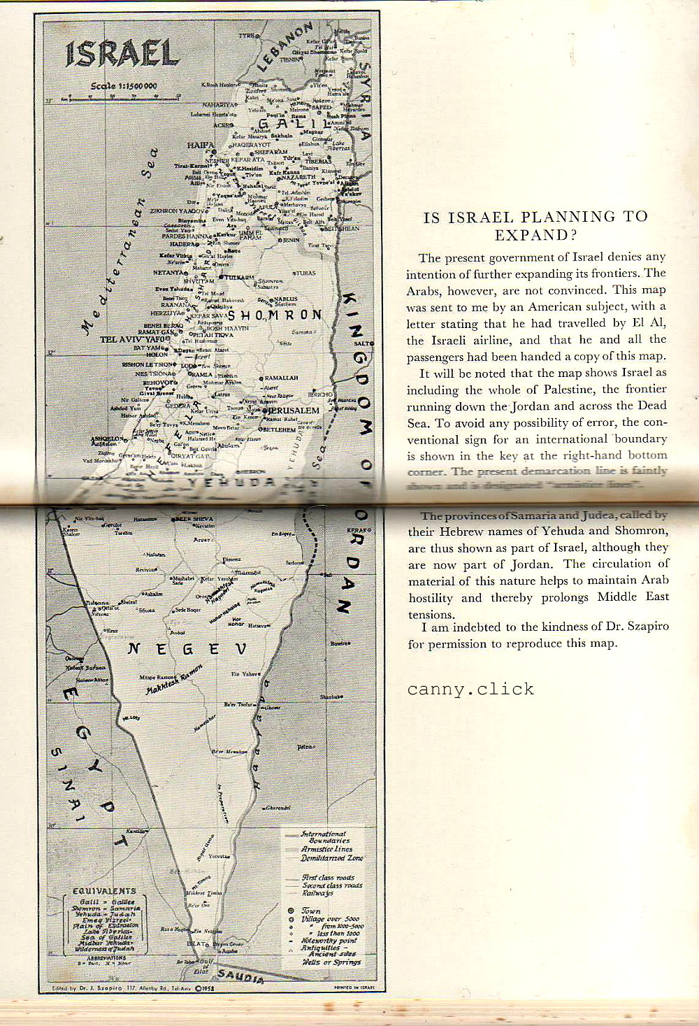
From Britain and the Arabs: A Study of Fifty Years, 1908 to 1958, by Lieutenant-General Sir John Bagot Glubb, 1959.
The text reads: IS ISRAEL PLANNING TO EXPAND? The present government of Israel denies any intention of further expanding its frontiers. The Arabs, however, are not convinced. [Ed: Those silly, paranoid Arabs!] This map was sent to me by an American subject, with a letter stating that he had travelled by El Al, the Israeli airline, and that he and all the passengers had been handed a copy of this map. It will be noted that the map shows Israel as including the whole of Palestine, the frontier running down the Jordan and across the Dead Sea. To avoid any possibility of error, the conventional sign for an international boundary is shown in the key at the right-hand bottom corner. The present demarcation line is faintly shown and is designated "armistice lines". The provinces of Samaria and Judea, called by their Hebrew names of Yehuda and Shomron, are thus shown as part of Israel, although they are now part of Jordan. The circulation of material of this nature helps to maintain Arab hostility and thereby prolongs Middle East tensions. I am indebted to the kindness of Dr. Szapiro for permission to reproduce this map.